
Let’s talk about chokepoints.
Apparently, the world decided to route 80% of global trade through a handful of suspiciously narrow gaps in the geography.
Like our bodily systems, when things are running smoothly, we don’t think about them individually all that much.
We rarely wake up thinking, “I’m so glad my airway is open and my arteries are capable of blood flow!” (Although maybe we should.) But, if something cuts off a critical pathway, like our esophagus, it doesn’t take long to feel the pain.
Now, due to geopolitical incidents, the Strait of Hormuz is getting a lot of love from the media, politicians, dinner tables, and watercoolers. So let’s dive into some under-loved chokepoints around the world and see where we’ve got some potential trouble brewing.
Did you know that chokepoints come in lots of fun flavors? If you did, good for you. If not, here’s a cheat sheet for your next dinner party or office conversation.
Chokepoints can be broadly grouped into nature-made and human-made options. (Or alien-made if you’re into that kinda thing.)
Geographic
Maritime straits
These are our natural geographic features: narrow bodies of water between two landmasses.
Nobody built them; plate tectonics just happened to leave an inconveniently small gap between countries. Because they're natural, they fall under international maritime law (specifically UNCLOS), which theoretically guarantees "transit passage" rights to all vessels.
The catch is that the bordering nations still control enforcement (neat, right?), and a country like Iran or Turkey can make that passage very uncomfortable, very quickly, whether through military presence, mining, or simply saying "no" and daring someone to argue about it. (We call the daring and arguing part “politics” in case you were curious.)
DID YOU KNOW
The United Nations Convention on the Law of the Sea (UNCLOS), adopted in 1982 and in force since 1994, is the comprehensive international legal framework governing all ocean space, maritime resources, and maritime zones. It defines rights for coastal states and maritime navigation, including the 12-mile territorial sea and 200-mile Exclusive Economic Zone (EEZ).
Canals
Canals are the man-made version of the same idea: humans looked at a map, decided nature was being inefficient, and dug a shortcut.
The key difference from straits is that a single sovereign nation owns and operates them outright, with no international law obligation to let anyone through.
Egypt can close the Suez Canal whenever it wants.
Panama can and does restrict traffic during droughts.
Canals are also physically vulnerable in ways straits aren't. A canal is a concrete and steel infrastructure project that can be damaged, blocked (as a certain container ship demonstrated in 2021—we’re looking at you, Ever Given), or simply run out of water. If you’re wondering how often that happens, check out this post on major canals and their myriad woes.
Land corridors
Land corridors work on the same principle but for overland trade: roads, rail lines, and mountain passes that happen to be the only practical route between two regions.
The Khyber Pass is just a mountain gap.
The Trans-Siberian Railway is an infrastructure network.
What they share is that land corridors are almost always under the complete control of the nation they pass through, with zero international right of passage. Russia proved this definitively when it weaponized its rail corridors after 2022.
Yes, I realize that the examples for land corridors include human-made elements… just go with it.
Infrastructure
Air hubs
Air hubs are a deliberate investment in infrastructure and face different threat styles from our geo-based friends.
Disruptions like pandemics, conflict, extreme weather, or labor issues can send ripples through the global supply chain. Specifically vulnerable: time-sensitive goods like pharmaceuticals, electronics, and perishables.
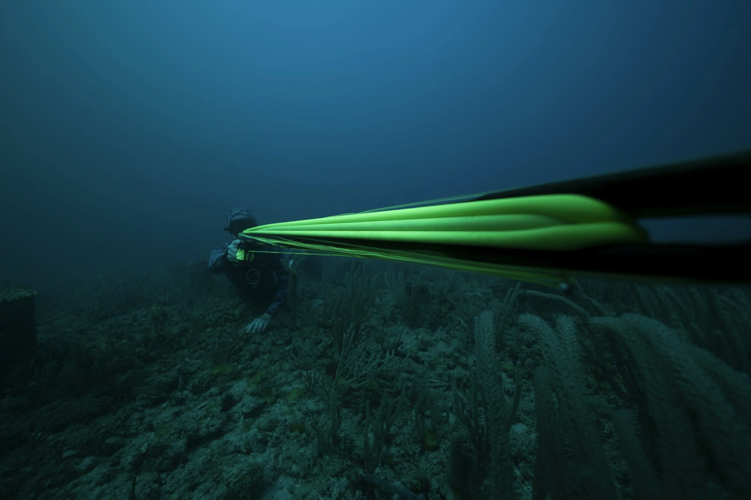
Digital/undersea cable routes
The underappreciated, and unseen, infrastructure chokepoint is digital undersea cable.
Guess what…
Around 95% of all international internet traffic, including the financial transactions underpinning our global trade, runs through the physical cables on the ocean floor. .
While they’re a critical part of our supply chain and global economic systems, they’re largely unprotected. They run through international waters and can be severed by a ship anchor, an earthquake, or a submarine. (Or a mega-shark.)
They do follow a similar geographic logic to maritime routes, clustering near coastlines and straits. Unlike a blocked canal or closed maritime strait, a cut cable isn’t always obvious right away, making attributing deliberate cable sabotage extremely difficult. (Don’t get any ideas.)
Energy pipelines
Energy pipelines are in their own category because they carry a single commodity under continuous pressure, so they’re a magical (I mean disastrous) combination of critical and brittle. A maritime strait can be rerouted around at significant cost; a pipeline either works or it doesn't. They also tend to create long-term political dependency–the kind of political dependency that is complex, especially when mingled with administration or regime changes. Europe's decades-long reliance on Russian gas via pipeline infrastructure is the textbook example of how a chokepoint becomes a geopolitical lever.
We get to enjoy a spectrum of strategic chokepoints, with varying levels of access, aggravation, and defense. Natural straits are harder to permanently close but easier to harass; canals and pipelines are easier to control but also easier to damage; digital cables are the most fragile and the least defended.
Turn page for more chokepoint horror
Still here and wanting more potentially depressing news? Me too. Let’s dig into the who’s who of strategic chokepoints.
Strait of Malacca
Chokepoint type: Maritime Strait
Location: Between Malaysia, Singapore and Indonesia
Risk level: Critical
Who’s at the table?
Singapore
Malaysia
Indonesia
China
United States
Japan
South Korea
Risk categories: Energy, geopolitics, naval
Impact summary: The Strait of Malacca sees approximately 25-30% of global trade, and is a primary route for East Asian energy imports and manufactured goods.
Fun fact: The Strait of Malacca sees about 100,000 ships pass through per year, including approximately 15 millions barrels of oil per day.
Threats: Piracy, territorial disputes, China-US naval tension, environmental accidents.
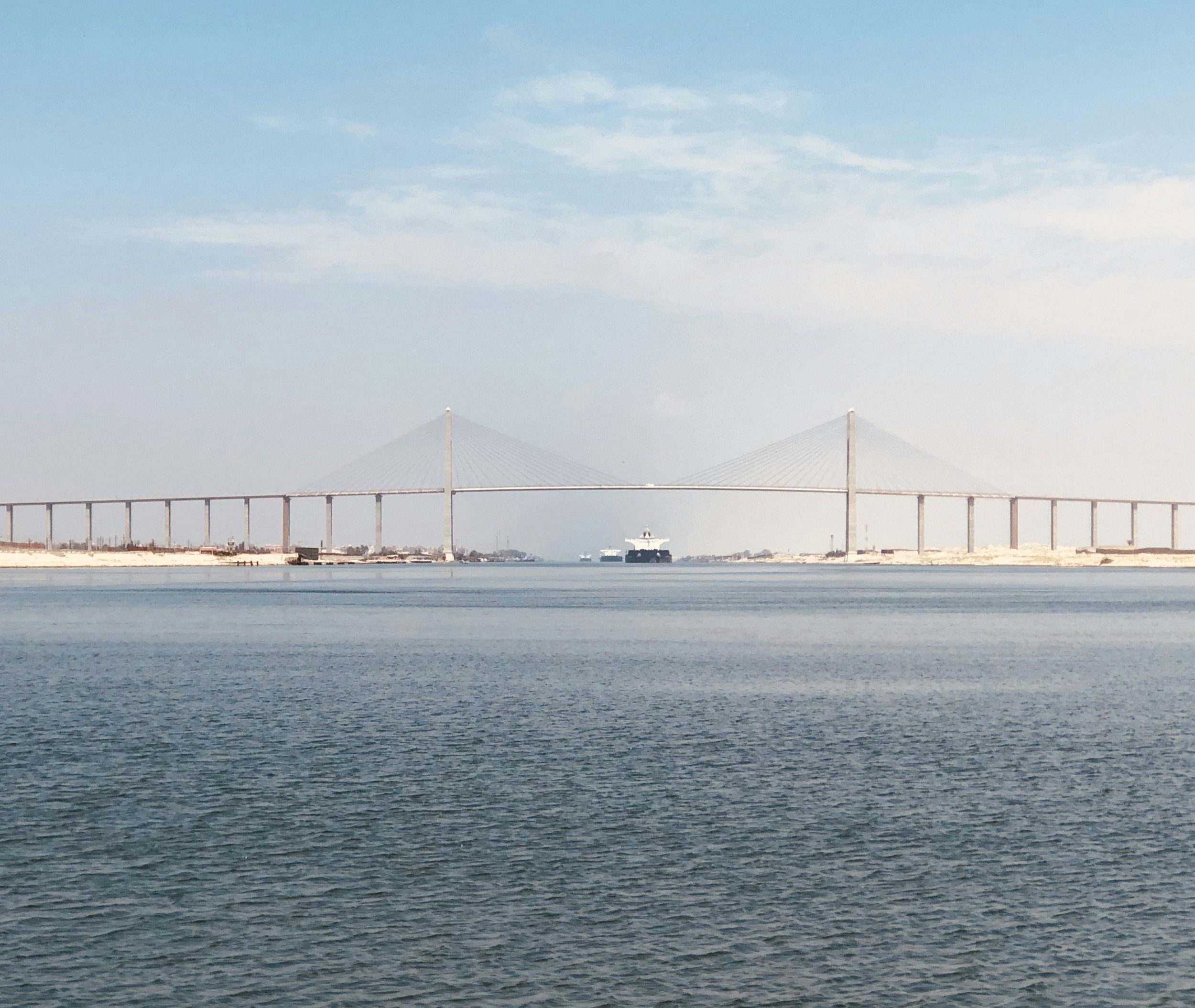
Suez Canal
Chokepoint type: Canal
Location: Egypt, from the Red Sea to the Mediterranean
Risk level: Critical
Who’s at the table?
Egypt (sole controller)
China (major user)
European importers
United States
Houthi rebels (indirect, but still very real, threat)
Risk categories: Energy, geopolitics, containers
Impact summary: The Suez Canal sees 12-15% of global trade and is a key Europe-Asian shortcut. Approximately 19,000 ships pass through per year.
Fun fact: Every day of a Suez Canal closure adds 10+ days and ~$10M per voyage. Canal closed? Time to walk like an Egyptian.
Threats: Houthi missile and drone attacks, Egyptian political instability, terrorism, ship groundings (oh hey, Ever Given… we’re looking at you.)
Panama Canal
Chokepoint type: Canal
Location: Central America, Pacific to Atlantic Ocean connection
Risk level: High
Who’s at the table?
Panama (duh; sole controller)
United States
China (Hutchison Ports)
Columbia
Shipping alliances
Risk categories: Trade, climate, LNG (liquified natural gas)
Impact summary: With approximately 5% of global tradetrande and a key stake in LNG, grain, and container ships, the Panama Canal is not to be underestimated. About 14,000 ships per year pass between the Atlantic and Pacific Oceans.
Fun fact: The canal doesn't use seawater. The canal relies on Gatún Lake, a man-made freshwater reservoir, which supplies the water used to fill the locks that raise ships over Panama's terrain.Every ship transit literally flushes millions of gallons of fresh water into the ocean, which means the canal is perpetually dependent on rainfall replenishing the lake. The canal uses about two and a half times the amount of water that New York City uses, just for operations.
Threats: Drought and low water levels (El Nino rears its ugly head), Climate change impact Gatun Lake water levels, geopolitical tension, aging infrastructure.
Strait of Hormuz
(aka Belle of the Ball these days)
Chokepoint type: Maritime Strait
Location: Persian Gulf / Arabian Sea — between Iran and the Arabian Peninsula
Risk level: Critical
Who's at the table?
Iran (controls the northern shore — and never lets anyone forget it)
United Arab Emirates
Oman
United States 5th Fleet
Saudi Arabia
China (the world's largest oil importer and therefore very invested in keeping this open)
Risk categories: Energy, geopolitics, naval
Impact summary: Roughly 20% of the world's oil supply passes through this strait every single day. A closure wouldn't just spike energy prices — it would trigger an immediate global economic shock. About 21 million barrels of oil and 17% of the world's LNG move through here daily, making it the single most consequential chokepoint on the planet for energy markets.
Fun fact: Iran doesn't actually need to close the Strait of Hormuz to extract enormous geopolitical leverage from it. The credible threat of closure is enough to make every major oil-importing nation treat Tehran with a certain degree of diplomatic caution. It's the world's most expensive bluff — and it works whether or not the cards are ever played.
Threats: Iranian naval blockade or mining, regional conflict spillover, tanker attacks and drone swarms, US–Iran escalation.
Bab-el-Mandeb
Chokepoint type: Maritime Strait
Location: Between Yemen and Djibouti — the southern entrance to the Red Sea
Risk level: Critical
Who's at the table?
Yemen / Houthi forces (currently the most disruptive actor in global shipping)
Djibouti (hosts more foreign military bases per square mile than almost anywhere)
Eritrea
United States (military base in Djibouti)
EU Naval Force
Saudi Arabia
United Kingdom and France
Risk categories: Energy, geopolitics, active conflict
Impact summary: This strait is the gateway to the Suez Canal, and roughly 10% of global trade must pass through it. Approximately 21,000 ships per year transit the strait, carrying around 4 million barrels of oil per day. A closure forces the entire Europe–Asia trade route around the Cape of Good Hope, adding nearly two weeks and significant cost to every voyage. Since late 2023, Houthi attacks have effectively functioned as a de facto closure for many shipping companies.
Fun fact: The name 'Bab-el-Mandeb' translates from Arabic as 'Gate of Tears' or 'Gate of Grief.' Ancient mariners named it for the dangerous conditions and the grief caused by the many ships that sank there. Modern shipping executives have found the name newly appropriate since 2023, though for entirely different reasons.
Threats: Ongoing Houthi attacks on commercial shipping (100+ vessels targeted since November 2023), piracy, Yemen civil war spillover, Iran using proxy forces to weaponize one of the world's most critical trade routes.
Turkish Straits (Bosphorus & Dardanelles)
Chokepoint type: Maritime Strait
Location: Turkey — connecting the Black Sea to the Mediterranean
Risk level: High
Who's at the table?
Turkey (sole controller and shrewd diplomatic player)
Russia (whose Black Sea fleet depends entirely on Turkish goodwill)
Ukraine
NATO
Bulgaria and Romania
Georgia
Risk categories: Energy, grain exports, geopolitics
Impact summary: These two straits are the only maritime passage between the Black Sea and the rest of the world's oceans. Approximately 45,000 ships transit annually, carrying around 3% of global oil. After Russia's invasion of Ukraine, Turkey invoked the Montreux Convention to restrict warship passage — demonstrating just how much leverage a single country can exercise over a narrow body of water. Ukraine's grain exports, critical for food security in North Africa and the Middle East, depend entirely on this route.
Fun fact: The Bosphorus runs directly through the middle of Istanbul, one of the world's great cities. Ships carrying oil, grain, and heavy cargo navigate a strait that is, in places, flanked by apartment buildings, restaurants, and mosques. The city of 15 million people essentially has a superhighway of supertankers running through its living room, 365 days a year.
Threats: Russia-Ukraine war escalation, Turkey leveraging access as a political bargaining chip (something it has shown no hesitation in doing), environmental catastrophe risk from a major tanker accident in a heavily populated urban area, NATO-Russia tensions.
Strait of Gibraltar
Chokepoint type: Maritime Strait
Location: Between Spain and Morocco — connecting the Mediterranean Sea to the Atlantic Ocean
Risk level: Moderate
Who's at the table?
United Kingdom (controls Gibraltar — a source of ongoing diplomatic awkwardness)
Spain (which would very much like Gibraltar back)
Morocco
NATO
European Union
Risk categories: Trade, geopolitics, migration
Impact summary: Every ship entering or leaving the Mediterranean must pass through this 9-mile-wide strait. Around 100,000 ships transit annually, making it the gateway for all Mediterranean trade to global oceans. Energy shipments, container traffic, and naval vessels from dozens of nations all funnel through this single point. It also happens to be one of the busiest migration crossing points in the world, adding a humanitarian dimension to its strategic importance.
Fun fact: The Rock of Gibraltar — the famous landmark that dominates the strait — is home to Europe's only wild primate population: the Barbary macaques. There is a longstanding legend that if the macaques ever leave Gibraltar, British sovereignty over the territory will end. Winston Churchill, during World War II, was apparently concerned enough about declining macaque numbers to order that the population be reinforced. British military strategy and monkey population management: not a combination you see every day.
Threats: Spain-Morocco political tensions, the perpetually unresolved UK-Spain dispute over Gibraltar sovereignty, smuggling and migration pressure, terrorism.
Lombok & Sunda Straits
Chokepoint type: Maritime Strait
Location: Indonesia — alternative routes to the Strait of Malacca
Risk level: Moderate
Who's at the table?
Indonesia (sovereign over both straits)
China (major user of alternative routes)
Japan
Australia
United States Navy
Risk categories: Energy, alternative routing, seismic activity
Impact summary: These straits serve as the primary alternatives to the Strait of Malacca for vessels too large to navigate it — particularly supertankers carrying oil. As Malacca pressure increases, these routes become increasingly important. They sit in one of the most geologically active regions on Earth, which adds a layer of risk that most shipping lanes don't have to contend with.
Fun fact: The Sunda Strait sits immediately next to the Krakatau volcanic complex — the site of one of the most catastrophic volcanic eruptions in recorded history, in 1883. The eruption was so loud it was heard 3,000 miles away in Australia. A child volcano, Anak Krakatau ('Child of Krakatau'), grew from the caldera and dramatically collapsed into the sea in 2018, generating a tsunami that killed more than 400 people. The world's alternative oil shipping route runs right past it.
Threats: Volcanic activity (Anak Krakatau remains active), Indonesian territorial enforcement, piracy, navigational hazards from irregular seabed topography.
Taiwan Strait
Chokepoint type: Maritime Strait
Location: Between Taiwan and mainland China — western Pacific Ocean
Risk level: Critical
Who's at the table?
China / PRC (views Taiwan as a rogue province; views the strait accordingly)
Taiwan (disagrees, firmly)
United States (treaty-bound to ensure Taiwan's security)
Japan (the strait's closure would be an existential economic problem)
South Korea
TSMC and the global semiconductor supply chain
Risk categories: Semiconductors, geopolitics, naval
Impact summary: Approximately 50% of global container ships transit the Taiwan Strait each year. But the more alarming concentration is on land: TSMC, headquartered in Taiwan, manufactures over 60% of the world's advanced semiconductors. A conflict here wouldn't just disrupt shipping — it would freeze global electronics production. Every major tech company on Earth depends on chips that come from this island. The strait is not just a shipping lane; it is the single most dangerous geopolitical flashpoint in the global technology supply chain.
Fun fact: TSMC's most advanced chip fabrication facilities — the ones that produce the chips inside your phone, your car, your laptop, and most modern weapons systems — cannot be quickly relocated or replicated. Building a comparable facility takes roughly 5–10 years and tens of billions of dollars, and requires a concentration of specialized engineers and supply chain infrastructure that exists almost nowhere else. The world has, entirely accidentally, made a small island in a contested strait the irreplaceable keystone of the entire global technology economy.
Threats: China-Taiwan military conflict, PLA naval exercises that periodically close airspace and shipping lanes, accidental military escalation, US-China confrontation triggered by arms sales or diplomatic recognition.
Dover Strait
Chokepoint type: Maritime Strait
Location: Between the United Kingdom and France — the English Channel at its narrowest
Risk level: Moderate
Who's at the table?
United Kingdom
France
Belgium
Netherlands
European Union
Eurotunnel (the Channel Tunnel operator, whose infrastructure runs right alongside)
Risk categories: Trade, post-Brexit regulation, migration
Impact summary: The Dover Strait is the single busiest maritime lane in the world by vessel count — 400 to 500 ships pass through every single day. It is the primary overland and sea route for UK-EU goods trade. In practical terms, a significant disruption here would affect supermarket shelves in Britain within days, given how much of the UK's food supply moves through this crossing.
Fun fact: The Dover Strait is so busy that it has its own dedicated traffic separation scheme — essentially a maritime highway with lanes going each direction — enforced by radar monitoring and coast guard vessels. Ships are not allowed to simply wander across it. Despite this, the strait still sees several collision incidents per year, because funneling 400+ ships daily through a 21-mile-wide gap is, it turns out, inherently precarious.
Threats: Post-Brexit customs and regulatory delays (which created genuine supply chain disruption immediately after 2021), collisions in extremely high-density traffic, damage to undersea cables that run through the same corridor, extreme weather events.
Cape of Good Hope
Chokepoint type: Maritime Strait
Location: South Africa — southern tip of Africa, connecting the Indian and Atlantic Oceans
Risk level: Moderate
Who's at the table?
South Africa
Global shipping lines (who would strongly prefer not to be here)
Insurance markets (who price the weather risk accordingly)
China (heavy user during Suez disruptions)
Risk categories: Alternative routing, energy, weather risk
Impact summary: The Cape of Good Hope is the world's main backup plan when the Suez Canal is unavailable. During the 2023–2024 Houthi crisis, it went from a rarely used alternative to one of the busiest trade routes on Earth almost overnight, as hundreds of vessels rerouted to avoid the Red Sea. It handles surge capacity worth billions in goods, but adds 10–14 days and roughly $1 million in fuel costs per voyage compared to the Suez route.
Fun fact: The Cape of Good Hope is not actually the southernmost point of Africa — that distinction belongs to Cape Agulhas, about 90 miles to the southeast. The Cape of Good Hope got its famous name from Portuguese King John II, who renamed it from its original, more honest name: 'Cape of Storms.' The rebrand was apparently intended to boost investor confidence in the India trade route. Sixteenth century spin doctors were doing their best.
Threats: Severe storms (the Cape is notorious for them — the Agulhas Current creates some of the most unpredictable seas in the world), South African port inefficiency and congestion, long transit times that increase overall shipping costs significantly.
Cape Horn
Chokepoint type: Maritime Strait
Location: Chile — the southern tip of South America, connecting the Pacific and Atlantic Oceans
Risk level: Moderate
Who's at the table?
Chile
Argentina
Global shipping companies (mostly reluctantly)
Military transit users
Risk categories: Alternative routing, weather risk, bulk cargo
Impact summary: Cape Horn serves as the bypass route when the Panama Canal is unavailable or prohibitively expensive for certain vessel classes. Very large bulk carriers and LNG tankers that cannot physically fit through the Panama Canal's locks use this route as standard practice. It is increasingly relevant as Panama Canal drought restrictions have pushed more traffic to seek alternatives.
Fun fact: Cape Horn has a reputation among sailors as the most dangerous waters on Earth — not without justification. It sits at the convergence of three oceans, with no land mass between it and Antarctica to break the force of westerly winds, which can build waves over 60 feet high. Historically, so many ships and sailors were lost rounding the Horn that a sailor who had successfully done so was allowed to wear a gold earring as a mark of distinction. Sailors who had rounded it twice could wear two. What did you do to earn your jewelery?
Threats: Extreme and unpredictable weather (the most genuinely dangerous sailing conditions on the planet), remoteness making rescue operations extremely difficult, climate change gradually altering storm patterns in ways that are not yet fully understood.
Khyber Pass
Chokepoint type: Land Corridor
Location: Afghanistan / Pakistan border — connecting Central Asia to South Asia through the Hindu Kush mountains
Risk level: High
Who's at the table?
Pakistan
Afghanistan under Taliban control
United States (historically — 20 years of supply lines ran through here)
NATO (former heavy user)
Central Asian states
China (whose Belt and Road / CPEC infrastructure connects nearby)
Risk categories: Land trade, security, geopolitics
Impact summary: The Khyber Pass is one of the oldest and most historically significant trade and military corridors in the world, connecting the Indian subcontinent to Central Asia. It remains a major truck route for Pakistan-Afghanistan-Central Asia trade. For NATO, it was a critical supply line during 20 years of operations in Afghanistan. Under Taliban control, it has become significantly less predictable as a commercial route.
Fun fact: The Khyber Pass has been fought over continuously for at least 2,500 years. Alexander the Great used it. The Mughal Empire used it. The British Empire lost two entire armies trying to control it, in what became known as the Great Game. The Soviets, and then the Americans, also found it uncooperative. There is a stretch of the pass where the walls of rock are covered in regimental plaques left by British Army units — a kind of geological guest book of military failures. Proof we can’t all just get along.
Threats: Taliban control creating unpredictable access and taxation, terrorism and insurgency, Pakistan-Afghanistan political tensions periodically closing the border, criminal networks extracting tolls.
Suwalki Gap
Chokepoint type: Land Corridor
Location: Poland / Lithuania border — a narrow land corridor between Belarus and the Russian exclave of Kaliningrad
Risk level: High
Who's at the table?
Russia
Belarus (functionally a Russian proxy for this purpose)
Poland
Lithuania
NATO (whose entire Baltic defence strategy hinges on this 65-mile strip)
European Union
Risk categories: Military logistics, geopolitics, NATO defence
Impact summary: The Suwalki Gap is approximately 65 miles of Polish-Lithuanian border that represents the only land connection between the NATO Baltic states (Estonia, Latvia, Lithuania) and the rest of NATO territory. If Russia and Belarus were to close this gap, the Baltic states would be completely cut off from NATO reinforcement by land. It is widely considered NATO's single most vulnerable geographic point — a fact that NATO planners, Russian military strategists, and Belarusian officials are all entirely aware of.
Fun fact: NATO military planners have war-gamed the Suwalki Gap scenario extensively, and early assessments (later revised) suggested Russian forces could close it in roughly 60 hours if they chose to move. The scenario is considered serious enough that Lithuania, Latvia, and Estonia have invested heavily in their own national defense capabilities specifically because they cannot assume the Gap would remain open during a crisis.
Threats: Russian and Belarusian military pressure and positioning, hybrid warfare tactics including cyberattacks and disinformation, infrastructure sabotage, potential NATO Article 5 trigger scenario that could escalate to general conflict.
Trans-Siberian / Russia Rail Corridors
Chokepoint type: Land Corridor
Location: Russia — connecting Europe to Asia overland through Siberia
Risk level: High
Who's at the table?
Russia (which has demonstrated willingness to weaponize this access)
China (still using it, but hedging with alternatives)
EU member states (now largely excluded by sanctions)
Kazakhstan
Central Asian states
Risk categories: Rail freight, sanctions, geopolitics
Impact summary: The Trans-Siberian Railway and associated Russian rail corridors were, before 2022, a major overland container route between Europe and China — handling around 200,000 containers per year. It offered a significantly faster alternative to sea freight for time-sensitive goods. Russia's invasion of Ukraine triggered sanctions that effectively closed this route to most European companies, demonstrating precisely how dangerous it is to route critical trade infrastructure through a single country's sovereign territory.
Fun fact: The Trans-Siberian Railway is the longest railway in the world at 5,772 miles, crossing 8 time zones. A passenger journey from Moscow to Vladivostok takes approximately 7 days without stops. It passes through so much of Russia's industrial and natural resource heartland that controlling it was considered militarily critical during World War II — Germany's failure to cut it was one of the factors that allowed the Soviet Union to relocate entire factories eastward out of the path of the invasion.
Threats: Russia-Ukraine war and associated Western sanctions, fundamental dependence on Russian infrastructure goodwill, political weaponization of rail access, growing competition from the Middle Corridor alternative.
Middle Corridor (Trans-Caspian Route)
Chokepoint type: Land Corridor
Location: Central Asia — connecting China to Europe via Kazakhstan, the Caspian Sea, Azerbaijan, Georgia, and Turkey
Risk level: Moderate
Who's at the table?
China (the primary driver of investment)
Kazakhstan
Azerbaijan
Georgia
Turkey
European Union (actively encouraging development as an alternative to Russian routes)
Uzbekistan
Risk categories: Rail freight, alternative routing, geopolitics
Impact summary: The Middle Corridor emerged as the primary alternative to Russian rail routes after 2022 sanctions. Traffic has grown rapidly, handling around 11 million tonnes per year and increasing. The route crosses the Caspian Sea by ferry — an inherent bottleneck — and passes through multiple border crossings, but it offers the crucial advantage of entirely bypassing Russian territory.
Fun fact: The Middle Corridor requires ships to cross the Caspian Sea, which is technically the world's largest lake (it just looks like a sea because of its size). Landlocked since ancient geological times, the Caspian has no direct connection to any ocean, which means every container crossing it has to be loaded onto a ferry, sailed across, and reloaded onto a train on the other side. It is, logistically, an extraordinarily inelegant solution — but after 2022, it was the only solution that didn't involve asking Russia for a favor.
Threats: Chronic underinvestment in infrastructure at key bottlenecks, complexity of the Caspian ferry crossing, multiple border crossings each adding delay and cost, geopolitical instability in the South Caucasus.
Dubai / UAE Air Hub
Chokepoint type: Air Hub
Location: Middle East — Dubai and Abu Dhabi, United Arab Emirates
Risk level: Moderate
Who's at the table?
United Arab Emirates
Emirates Airline (the airline that made Dubai's hub strategy work)
Etihad Airways
International carriers from every major economy
China (significant cargo volumes)
India (enormous diaspora traffic volumes)
Risk categories: Air freight, logistics hub, regional stability
Impact summary: Emirates and UAE airports collectively handle approximately 20% of global air freight, and Dubai International is the world's busiest airport by international passenger numbers. The UAE's strategic position between Europe, Asia, Africa, and the Indian subcontinent makes it an almost geometrically ideal hub. Time-sensitive cargo — pharmaceuticals, electronics, perishables — depends heavily on this infrastructure.
Fun fact: Dubai's emergence as a global aviation hub was entirely deliberate and almost improbably successful. In the 1980s, Emirates airline was founded with a $10 million government grant and two leased aircraft. Today it operates one of the largest long-haul fleets in the world and has effectively turned a desert city-state with no geographic air traffic advantage into the most connected aviation hub on the planet, largely through the force of strategic investment and the absence of the regulatory and union complications that hampered competitors elsewhere.
Threats: Regional conflict escalation across the Middle East, Iran-Gulf tensions that could close regional airspace, Houthi drone and missile range extending toward UAE territory (demonstrated in 2022 attacks on Abu Dhabi), extreme heat events disrupting operations as climate change progresses.
Singapore Changi Air Hub
Chokepoint type: Air Hub
Location: Southeast Asia — Singapore
Risk level: Moderate
Who's at the table?
Singapore (which has built its entire economic model around being an indispensable hub)
Singapore Airlines
DHL and FedEx Asia operations
Regional airlines
China
Australia
Risk categories: Air freight, technology supply chain, Asia-Pacific
Impact summary: Singapore Changi is the critical Asia-Pacific air freight hub, handling around 2 million tonnes of air cargo per year. It is the primary gateway for time-sensitive goods — semiconductors, pharmaceuticals, electronics components — moving across the Asia-Pacific region. Its disruption would particularly affect technology supply chains, given Singapore's position at the intersection of Southeast Asian manufacturing and global tech company distribution networks.
Fun fact: Changi Airport consistently ranks as the world's best airport and has done so for most of the past decade. It contains a butterfly garden, a sunflower garden, a movie theatre, a swimming pool (for transit passengers), a 40-metre indoor waterfall, and approximately four times more to do than most cities of Singapore's size. It is simultaneously critical global infrastructure and the world's most aggressively over-engineered airport. Singapore has essentially decided that if you must be dependent on a single hub, it should at least have a butterfly garden.
Threats: China-Taiwan conflict disrupting regional airspace, climate disruption and extreme weather events, pandemic-style airspace closures, growing competition from Chinese hub airports as they modernize and expand.
Undersea Cable Routes (Atlantic)
Chokepoint type: Digital / Cable
Location: North Atlantic — connecting the United States to Europe
Risk level: High
Who's at the table?
United States
United Kingdom
European Union
Russia (documented threat actor against Atlantic cables)
Tech giants — Google, Meta, Amazon (who now own significant portions of the cable network)
NATO
Risk categories: Internet infrastructure, financial systems, sabotage risk
Impact summary: Approximately 95% of all transatlantic internet traffic runs through physical cables on the ocean floor. This includes the financial transaction data underpinning global markets, cloud computing infrastructure, telecommunications, and virtually every other form of digital communication between the Americas and Europe. High-frequency trading firms measure competitive advantage in microseconds — a disrupted cable can move billions of dollars between market participants within seconds of failing.
Fun fact: The first transatlantic telegraph cable was completed in 1858 and hailed as one of the greatest engineering achievements in human history. Queen Victoria and President Buchanan exchanged congratulatory messages. The cable then failed completely after 26 days. It took eight more years to successfully lay a working permanent cable. The modern cables that carry the world's internet are significantly more robust — but they are also cut approximately 100–200 times per year globally, almost always accidentally, almost always by ship anchors.
Threats: Russian submarine activity near cable routes (documented by NATO and UK intelligence), ship anchor dragging (the leading cause of cable cuts globally), deliberate sabotage (the Nord Stream pipeline precedent showed this is not theoretical), seismic events on the ocean floor.
Undersea Cable Routes (Indo-Pacific)
Chokepoint type: Digital / Cable
Location: Pacific Ocean — connecting Asia to the United States and Australia
Risk level: High
Who's at the table?
United States
China
Japan
Australia
Taiwan (cables cluster near the island for obvious geographic reasons)
Singapore
Tech giants
Risk categories: Internet infrastructure, semiconductor data flows, geopolitics
Impact summary: The Indo-Pacific undersea cable network is the backbone of the entire Asia-Pacific internet, carrying the data flows that underpin the region's technology industry, financial markets, and communications. Critically, many of these cables run near or through the Taiwan Strait — meaning a military conflict over Taiwan would likely damage or sever multiple cables simultaneously, combining a physical shipping disruption with a digital communications blackout.
Fun fact: China has been quietly building its own undersea cable infrastructure as part of a broader strategy to reduce dependence on cables owned or monitored by Western companies and governments. Meanwhile, the US has been pressuring Pacific island nations not to land Chinese-built cables on their shores. The ocean floor has, without most people noticing, become a significant front in the technology cold war between the US and China.
Threats: China-Taiwan military conflict (cables physically run near Taiwan), South China Sea territorial disputes providing cover for interference, deliberate sabotage, US-China tech decoupling reducing cooperation on cable security and repair.
Hormuz Bypass Pipelines
Chokepoint type: Energy Pipeline
Location: Gulf region — UAE and Saudi Arabia, bypassing the Strait of Hormuz
Risk level: Moderate
Who's at the table?
Saudi Arabia
United Arab Emirates
Iran (whose strategic leverage is partly reduced by these pipelines, which it dislikes)
OPEC+
Global oil markets
Risk categories: Energy, oil infrastructure, bypass capacity
Impact summary: The UAE's Habshan–Fujairah pipeline and Saudi Arabia's East-West pipeline were built specifically to allow Gulf oil to reach export terminals without passing through the Strait of Hormuz. The UAE pipeline has a capacity of around 1.8 million barrels per day; the Saudi pipeline can carry up to 5 million. They are the world's most important insurance policy against an Iranian blockade — but they cover only a fraction of the 21 million barrels per day that normally flows through Hormuz.
Fun fact: Saudi Arabia's East-West pipeline, built in the 1980s, was designed with one primary purpose: to ensure Saudi oil could reach export markets even if Iran blocked the Strait of Hormuz. It cost billions to build and runs nearly 750 miles across the Arabian desert. It is, in effect, a multi-billion-dollar geopolitical hedge against a country that may or may not block a strait that it probably won't block but absolutely could. Geopolitical infrastructure planning is expensive.
Threats: Pipeline sabotage (the Saudi Aramco drone and missile attacks in 2019 demonstrated the vulnerability), limited spare capacity that covers only a portion of Hormuz flows, political decisions to halt operations, direct infrastructure attacks.
Druzhba Oil Pipeline (Europe)
Chokepoint type: Energy Pipeline
Location: Russia to Central and Eastern Europe — the world's longest oil pipeline
Risk level: High
Who's at the table?
Russia / Transneft (operator — and not above using pipeline access as a political lever)
Germany
Poland
Czech Republic
Hungary (which has been conspicuously reluctant to join EU sanctions)
Ukraine (through whose territory it still partially runs, awkwardly)
Risk categories: Energy, sanctions, European supply security
Impact summary: The Druzhba pipeline ('Druzhba' means 'friendship' in Russian — make of that what you will) is the longest oil pipeline in the world, stretching over 4,000 kilometres. Before the Ukraine war, it supplied around 750,000 barrels per day to European refineries, representing roughly 10% of EU oil imports. Post-sanctions, flows have been dramatically reduced, forcing European refineries built specifically to process Russian crude to find and retool for alternative supplies.
Fun fact: The name 'Druzhba' was chosen during the Soviet era to symbolise friendship between the USSR and Eastern European nations. Hungary, Slovakia, and the Czech Republic continue to receive Russian oil through the southern branch of Druzhba under a sanctions exemption, making them simultaneously EU members, NATO allies, and customers of the country they are officially sanctioning. The irony of the pipeline's name has not been lost on anyone.
Threats: Russia weaponizing energy access as a geopolitical tool (demonstrated repeatedly), sabotage (the pipeline has already experienced suspicious interruptions), EU sanctions creating legal complications for continued operation, infrastructure deterioration from reduced investment and maintenance.
Arctic Shipping Routes (Northern Sea Route)
Chokepoint type: Maritime Strait
Location: Arctic Ocean — along Russia's northern coastline
Risk level: Moderate
Who's at the table?
Russia (sole controller — and actively charging for icebreaker escort services)
China (the most enthusiastic non-Russian advocate for Arctic routes)
Norway
United States
European Union
Global shipping companies (watching with interest as the ice retreats)
Risk categories: Climate change, geopolitics, emerging infrastructure
Impact summary: As Arctic ice retreats due to climate change, the Northern Sea Route along Russia's northern coast is becoming viable for an increasing portion of the year. It cuts the distance between Europe and Asia by approximately 40% compared to the Suez Canal route. Currently handling around 35 million tonnes per year, it is projected to grow dramatically by the 2030s. The catch is that Russia controls the entire route and charges accordingly.
Fun fact: Russia has the world's only fleet of nuclear-powered icebreakers — currently 4 in service with more under construction — which it uses to keep the Northern Sea Route open and to escort commercial vessels through ice. No other country has nuclear icebreakers. This means that as climate change makes the Arctic route increasingly attractive, the world may find itself trading dependence on the Suez Canal for dependence on Russian icebreaker escorts. Climate change solving one geopolitical dependency problem by creating another is arguably on-brand.
Threats: Russian control and toll-setting on the entire route, military militarization of the Arctic (Russia has been rebuilding Arctic military bases), extreme weather events that remain unpredictable and dangerous, year-round icebreaker dependency that gives Russia structural leverage.
Strait of Tiran
Chokepoint type: Maritime Strait
Location: Red Sea — the narrow entrance to the Gulf of Aqaba, between Saudi Arabia and Egypt
Risk level: Moderate
Who's at the table?
Saudi Arabia
Egypt
Israel (the strait is its only maritime access for the port of Eilat)
Jordan (dependent on Aqaba port access)
United States
Houthi forces (whose missile range extends to this area)
Risk categories: Geopolitics, energy access, regional conflict
Impact summary: The Strait of Tiran is the only maritime access point for the Israeli port of Eilat and the Jordanian port of Aqaba. It is narrow, strategically vital, and historically explosive: Egypt's closure of the strait in 1967 was one of the immediate triggers of the Six-Day War. It remains a perennial flashpoint, and with Houthi forces active in the Red Sea region since 2023, the already-tense geography has become more complicated.
Fun fact: The 1967 closure of the Strait of Tiran by Egypt was considered by Israel to be an act of war under international law — and Israel acted accordingly, launching the pre-emptive strikes that began the Six-Day War three weeks later. The war lasted six days, resulted in Israel capturing the Sinai Peninsula (including the strait), the West Bank, Gaza, and the Golan Heights, and fundamentally reshaped the Middle East in ways that are still being navigated more than 50 years later. One closed strait, six days, and consequences that have lasted half a century.
Threats: Israel-Hamas war and broader regional escalation, Houthi influence extending into the Red Sea and Gulf of Aqaba, Egypt-Israel tensions (historically significant), Iran proxy activity throughout the region.
Los Angeles / Long Beach Port Complex
Chokepoint type: Land Corridor
Location: Southern California, United States — San Pedro Bay
Risk level: Moderate
Who's at the table?
United States
China (the largest single trade partner by volume — for now)
Japan and South Korea
ILWU (the International Longshore and Warehouse Union, whose contract negotiations have the power to halt $400 billion in trade)
Maersk, MSC, and global shipping alliances
Risk categories: US trade, labour relations, domestic supply chain
Impact summary: The LA/Long Beach port complex handles approximately 40% of all US container imports — the single most critical port infrastructure in the United States. Over 9 million TEUs (twenty-foot equivalent container units) move through it annually, representing more than $400 billion in goods. When it backs up — as it did catastrophically during 2021 — the effects reach directly into consumer goods availability across the entire country within weeks.
Fun fact: During the 2021 supply chain crisis, so many container ships were anchored offshore waiting to unload that they were visible from the Los Angeles hills at night as a string of lights stretching to the horizon. At peak congestion, over 100 ships were waiting at anchor simultaneously — a queue that would have stretched 50 miles if laid end to end. The images became a symbol of how fragile just-in-time supply chains are when a single major node is overwhelmed.
Threats: Labour strikes and contract disputes (the ILWU has historically used contract renewals as leverage, and given they control access to 40% of US imports, they have considerable leverage to use), congestion and backlog events, earthquake and natural disaster risk in a seismically active region, cyberattacks on port management systems.
What happens when points get choked?
While you may be thinking this is a cut and dry answer, it’s weirder and more cascading than you’d probably imagine. Once you get past the, “ships can take a longer route” concept (which isn’t even usually true) you get into the knock-on effects that ripple through the global economy in ways that expose the mediocrely constructed house of cards that it is…
And boom goes the shipping cost
In our straits and canals, the immediate pain is shipping costs that spike, often within hours of a disruption occurring. When the Ever Given (yeah, I keep going there) blocked the Suez Canal in 2021, oil prices jumped almost 6% and tanker rates nearly doubled within just a few days. And that didn’t happen because oil had stopped moving (yet), it was speculative trader pricing. The mere expectation of disruption had an instant impact on prices.
Next up is your insurance premiums, following almost immediately. Underwriters reprice the risk of troublesome transit routes and those costs are often passed along to the end consumer because, well, big companies gotta make that money too.
A fun example? Ships rerouting on the Cape of Good Hope instead of through the Suez Canal adds about two weeks of transit time and $1 million in extra fuel and crew costs PER VOYAGE. Now please tell me you remember our Top 25 Chokepoints list above, or just scroll up, and remember that 19,000 ships pass through that canal every year. We’re talking major moolah here.
Get in line
Now we know that we’re not just delaying a ship or two when a chokepoint is compromised. Issues in straits, canals, and other throughpoints cause backlogs that take months to sort out even after it reopens.
Real world incident: In 2023 droughts caused the Panama Canal to cut transits by 30%. Over 200 ships were lining up at each end. They weren’t just waiting around drinking Mai Tais (we don’t think…), the cargo wasn’t arriving, which means products weren’t on shelves, manufacturing operations didn’t have materials, perishable goods were spoiling, and the ripple effect goes on. And it gets better. The ports that were expecting them were being scheduled around arrivals that never occurred, so the ships that were supposed to load after them couldn’t get to their berths. (Ever been at an airport that’s waiting for a plane to get to a gate so they can bring your plane in to board? Same thing. Except imagine that the planes are just going to get there two years late.)
Modern manufacturing woes
Ah, technology! Modern manufacturing runs on “just-in-time” supply chains—particularly automotive, electronics, and pharmaceuticals. That means the components get to the factory within days or hours before they need to be on the production line. There’s no warehouse with backup parts to run to. So if a container of components does arrive? Grinding halt. Neat, right?
Entire factories shut down during chokepoint disruptions and delays. Millions of dollars are lost in hours and hourly workers may go without pay. During sustained incidents they may be unable to pay rents or mortgages, car payments, and other critical bills.
Commodity calamity
Food and energy markets are super-sensitive to disruptions. They’re traded on futures markets where pricing is set by anticipated future supply, not the current supply and demand. Any credible threat to a chokepoint, even one that never materializes, can push prices up within days. (Thanks, global economy.)
You can see what’s happening with the Strait of Hormuz with oil in real time. Another example is grain through the Turkish Straits. Back in 2022, following the invasion of Ukraine, Russia managed to effectively weaponize Black Sea access, causing global wheat prices to spike by about 50%. This immediately caused food insecurity in North Africa and the Middle East because they import huge quantities of Ukrainian and Russian grain.
Rerouting dreams
Ahh, the idea of rerouting. It’s a lovely thought. But it’s not free or fast, and in some cases, basically impossible.
Not all ships can navigate certain routes. For example, very large crude carriers can’t transit the Suez regardless of cost, and only Russia’s nuclear icebreakers (we need to talk about nuclear icebreakers too… sounds cool) can reliably open the Arctic route year-round. If you’re thinking about navigating around Africa, consider that you’ll also need 10-12% more ships to move the same cargo load. Guess what? Those ships aren’t just sitting around… or even exist. Turns out building massive cargo ships isn’t a quick job either. Who’d have thought?
Case in point: In 2023-2024, both Panama and the Red Sea/Suez routes were disrupted simultaneously. Container ship demand surged overnight, and port congestion escalated worldwide, from Singapore to Rotterdam.
Chokepoint bargaining chips
It may not be surprising but it’s certainly underappreciated how much chokepoint disruptions reshape our political negotiations. Exploding beyond geographic borders, economics and political power are impacted in seconds depending on the nature of the disruption.
Get this: Egypt earns around $10 billion per year from Suez tolls. That’s 2-5% of their GNP and about 10% of their GDP during good years. Throw in some Houthi rebels firing missiles at ships and that dropped from $10 billion to $4 billion in ONE YEAR. Catastrophic for a country that was already hanging out in IMF bailout territory and beating back one of the highest inflation rates in the world.
The digital underground
Undersea cables get cut 100-200 times per year, on average, globally. When that happens, internet traffic reroutes automatically. Most users don’t notice a thing. BUT… financial markets are different. High-frequency trading firms measure latency in microseconds, and a disrupted transatlantic cable can move the competitive advantage between trading firms in different countries in ways that impact billions of dollars in seconds.
Deliberate, coordinated attacks on multiple cable routes simultaneously could be executed without most people knowing until the financial systems were failing in ways that look, and feel, just like a banking crisis.
If you’re wondering if the military considers this a real scenario, the answer is yes. As with most financial crisis, problems are compounded by public panic and the spread of information and misinformation across a tangled network of channels and talking heads.
Global chokepoints are everyone's business
The global economy is less a web than a series of threads, and an alarming number of them run through the same handful of narrow gaps in the world's geography. A geography that is controlled by countries and powers that don’t always get along, form and change alliances, and are impacted by everything from weather to holidays and religious observances.
Given that about 80% of all traded goods move by sea, and the majority of that passes through no more than a dozen critical chokepoints: the Strait of Hormuz, the Suez Canal, the Strait of Malacca, Bab-el-Mandeb, the Taiwan Strait, if you break one of those you haven't just delayed a shipment—you've potentially frozen a production line, spiked a commodity price, or broken a supplier relationship that took years to build.
These chokepoints aren’t unknown. I’m not telling you about newly formed geographic elements or exposing that undersea cables exist. We know that. The problem is that understanding them in isolation is essentially useless. Droughts in Panama, rebel factions in Yemen, political standoffs in Taiwan, or even just a ship piloted by someone who hasn’t had enough coffee can trigger cascading outcomes.
These disruptions are starting to occur back-to-back, even simultaneously. 2023 and 2024 brought us issues in the Panama Canal and Red Sea route that compressed global shipping capacity and increased vessel demand by 12% within 48 hours. Own a mega yacht? Want to start an Airbnb for shipping? Kidding… Or maybe not.
The moral of this story is: reacting quickly is great. Seeing it coming is better. Being able to deploy a real resolution within hours is best. One that’s aimed at preventing the threat from being realized or mitigating things in your favor quickly.
Mapping exposure: knowing which suppliers sit behind each chokepoint, which commodity inputs are vulnerable, which alternative routes exist and at what cost… That’s the kind of intelligence that isn’t intuitive or static. Ceasefires in Gaza change Red Sea economics in days. El Nino forecasted for two or three years out is already a problem for Panama Canal plans today.
Chokepoint risk isn’t just a place for naval strategists and commodity traders to play anymore. Translating the complexity of global trade flows, geopolitical exposure, infrastructure vulnerability, and human resource management need to be part of core business planning, linked to actionable intelligence.
The chokepoints aren't going away. If anything, climate change is creating new ones—and making existing ones less reliable—hooray! If you care about the predictable and cost efficient movement of goods, this probably isn’t the kind of thing to treat like an annual physical. It’s a live variable that requires constant visibility across your organization.